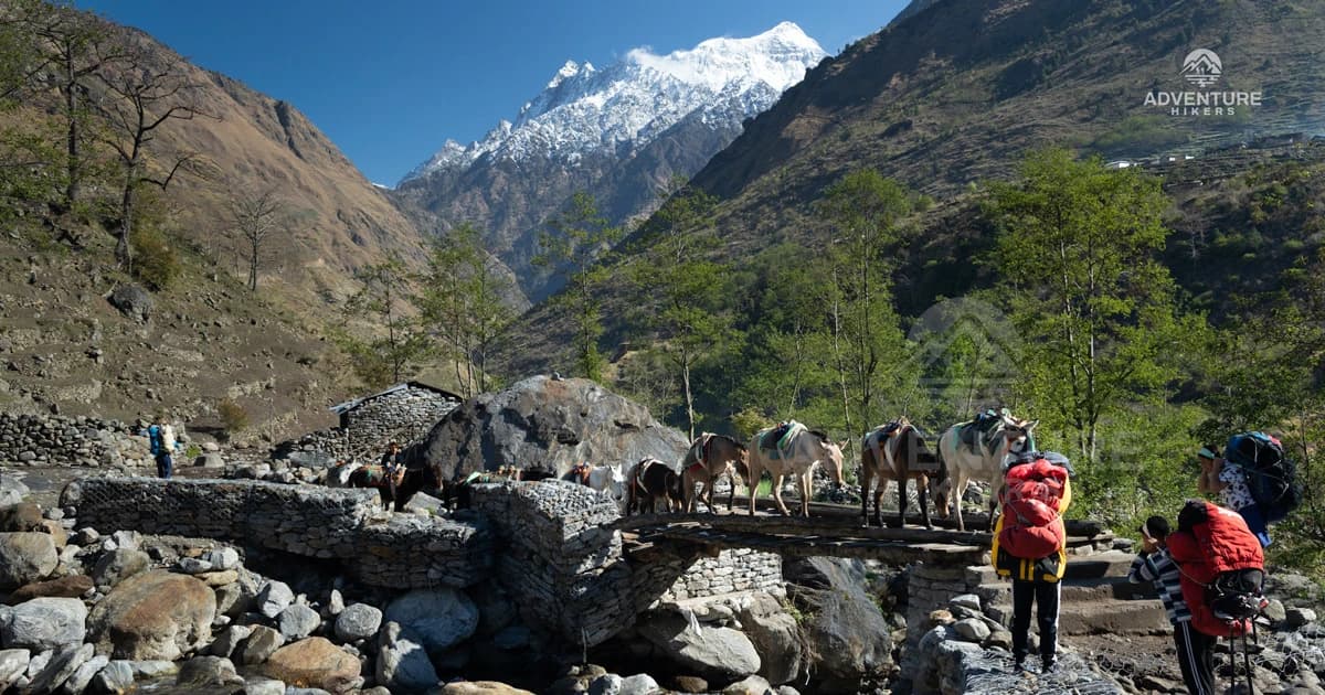
What makes this region special isn't just the lack of crowds, though. It's the sheer variety packed into one area. You start in a warm, green subtropical forest, pass through terraced farmland and traditional stone villages, and slowly climb into a stark, high-altitude desert that feels more like Tibet than Nepal.
Then there's Manaslu itself, the eighth highest mountain in the world, showing up again and again from different angles no matter which trail you choose. Whether you trek the classic Manaslu Circuit Trek or take the dedicated Manaslu Photography Trek, built specifically around the best light and viewpoints, few regions offer this much visual range in one trip.
Timing matters just as much as location when you're trying to capture the Manaslu Region at its best. The light hits the mountains differently depending on the season, the clouds behave differently, and even the color of the landscape changes from lush green in spring to golden brown in autumn. Show up at the wrong time and you might miss the clear skies over a high pass or the blooming rhododendrons lower down the trail.
In this guide, we'll walk you through the best photography spots across the Manaslu Region—from sunrise viewpoints like Syala Gaon and Pungyen Gompa to quiet monastery villages in Tsum Valley and dramatic high-altitude crossings—and break down exactly when to visit for the kind of light and scenery that makes a photo worth keeping.
Why the Manaslu Region Is a Photographer's Dream?
The region moves through several completely different landscapes in a short span, from subtropical forests and river valleys to terraced farmland, alpine meadows, and high-altitude deserts near the Tibetan border, giving photographers constant variety without needing to travel far.
Trails like the Manaslu Circuit Trek and Manaslu Base Camp Trek see far fewer trekkers than Everest or Annapurna, so you get cleaner compositions, quieter trails, and more natural, uninterrupted shots of villages and landscapes.
Lower footfall also means locals are more open and relaxed around visitors, making candid portraits and everyday village life much easier to capture authentically.
Manaslu, the eighth-highest mountain in the world, appears from multiple angles throughout the region, so you are not limited to just one iconic viewpoint like on many other routes.
The region passes through traditional Nubri- and Tsum-influenced villages with distinct architecture, prayer flags, mani walls, and monasteries, and the Tsum Valley Trek or longer Manaslu Tsum Valley Trek is built specifically to explore this side of the region.
High passes like Larkya La deliver some of the most dramatic high-altitude panoramas in Nepal, a major highlight on both the Manaslu Circuit and the Photography Trek.
Unmatched Sunrise & Sunset Light. Locations like Syala Gaon and Pungyen Gompa offer front-row views to capture the golden morning and evening light hitting the summit peak of Mt. Manaslu.
The region also offers strong wildlife and nature photography potential, with rhododendron forests in spring and glacier views near Bimthang and Samdo.
For those short on time, the Short Manaslu Trek still covers many of the region's best photography stretches in a shorter window.
Since the Manaslu Region is less commercialized overall, there is a rawer, more untouched feel to the photos coming out of it compared to more popular trekking areas.
Best Time of Year for Photography in the Manaslu Region
Spring, which runs from March to May, is one of the most rewarding seasons for photography across the Manaslu Region. This is when rhododendron forests burst into bloom along the lower and middle sections of the trail, adding deep reds and pinks against the green hillsides.
The valleys also tend to look fresher and more vivid this time of year, and the weather is generally stable enough to get clear shots of the mountains without too much haze building up later in the day. This is an excellent time for both the Manaslu Circuit Trek and the Tsum Valley Trek, as the lower forested sections become vibrant with color.
Autumn, from September to November, is widely considered the best season for mountain visibility, and for good reason. The skies are usually at their clearest, which makes this the ideal time to photograph Larkya La Pass and the surrounding peaks without clouds getting in the way. The harvest season also adds golden tones to the terraced fields lower on the route, giving a striking contrast to the icy blues and whites higher up.
If your main goal is sharp, clean shots of Manaslu and the high passes, autumn is the season to plan around, and it is also when the dedicated Photography Trek to Manaslu is best timed, since the whole itinerary is built to catch these clear conditions.
Winter brings quieter trails and snow-covered villages that photograph beautifully, though the cold and shorter days make routes like the Short trek to Manaslu or the Manaslu Base Camp Trek more practical choices during this period, since they cover less high-altitude terrain. Monsoon season, from June to August, is best avoided altogether, as heavy cloud cover and rain reduce visibility significantly and increase the risk of landslides on lower sections of the trail.
Best Photography Spots in the Manaslu Region
The Manaslu Region unfolds in stages, and each stretch of trail brings a different kind of shot, from river valleys and forest at the start to high-altitude desert and dramatic passes further in. Below is a breakdown of the standout photography spots along the route, starting with where most journeys begin.
Machha Khola
Generally in the Manslu region the trek starts from Machha Khola and walks along the Budhi Gandaki River to Jagat. This part of the trail is surrounded by green hills, forests, rivers, waterfalls and traditional villages. The high mountains are still some way off but there is plenty to photograph in the way of nature and local life in the lower Manaslu region. The morning light changing can lend a soft and warm feel to the landscape, particularly in the river and village areas.
- Tighten the Budhi Gandaki River snaking through the green valley.
- Take photos of the suspension bridges over the river, especially in the soft morning light.
- Snap pictures of waterfalls cascading down rocky hillsides beside the trail.
- Take pictures of green hills and terraced fields around the trail.
- Capture photos of the traditional houses and village life in and around Machha Khola and neighboring villages.
- Photograph trekkers on suspension bridges with hills in the background.
- Look for natural compositions of the trail, river, forest and rocky cliffs.
- The early morning gives good light and softer, clearer views of the surrounding landscape.
- Local people and everyday village life—capture it respectfully and with permission.
Jagat and Deng
The trail generally from Jagat to Deng goes deeper into the Manaslu territory along the Budhi Gandaki River through narrow gorges, forests, rocky cliffs and traditional villages. The scenery becomes more dramatic the higher you go, providing photographers with a combination of natural scenery and local Himalayan life. This part does a good job of capturing the contrast between the rushing river, high mountain walls and the quiet village setting.
- Enjoy the vast views of the Budhi Gandaki river flowing through the deep valley.
- Photograph the rugged rocky gorges and steep cliffs along the trail.
- See suspension bridges in forest and mountain settings.
- Photograph Jagat and other villages that have traditional stone houses and narrow streets.
- Look out for prayer flags and mannequins along the trail.
- Waterfalls flowing off the rocky cliffs are a must, especially if there is good water flow.
- Photograph pine, bamboo and rhododendron forest on the way.
- Take candid pictures of local village life, with permission.
- Shoot trekkers on the narrow trails above the river.
- Landscape photography is at its best in the soft light of early morning and late afternoon.
Namrung and Lho
This stretch is where the Manaslu Region really opens up for photographers. Namrung sits at around 2,660 meters, marking the point where the lower subtropical forest of the Budhi Gandaki valley begins to give way to open, high-altitude terrain, and from here the trail climbs to Lho at roughly 3,180 meters. Along the way, the dense forest thins and the summits of Himalchuli, Ngadi Chuli, and Siringi Himal come into view, with the massive north face of Mount Manaslu appearing right in front of trekkers as the standout moment of the walk. Visit Lho, a village at 3,180 meters, set against a dramatic alpine backdrop where architectural heritage blends with Himalayan majesty, dominated by the 12th-century Ribung Monastery with its whitewashed walls and golden roof.
- Manaslu's north face framed against thinning forest as the trail opens up.
- Barley fields around Lihi and Sho villages, especially warm-toned in autumn light.
- Ribung Monastery at sunset, when its golden roof catches the last light.
- Panoramic shot from the hilltop viewpoint above Lho, taking in the full Manaslu massif.
- Sunrise view of Manaslu from the popular viewpoint near the monastery.
Ribung Gompa (Lho Village)
While Lho village itself offers a strong view of Manaslu from the trail, the short climb up to Ribung Gompa is worth treating as its stop. Perched on a hilltop just above Lho, this short but rewarding uphill hike offers sweeping panoramic views over the valley, showcasing the entire Manaslu range. The monastery itself is striking too, a three-story structure built in classic Tibetan Buddhist architectural style, decorated with vivid mandalas, wall mantras, and symbolic carvings, with a serene statue of Buddha inside surrounded by sacred images of other deities. Timing matters here more than almost anywhere else on the trek, since the monastery's tiered walls, carved windows, and golden roof stand out especially when bathed in the honeyed glow of sunset.
- Wide panoramic shot of the Manaslu range from the hilltop viewpoint.
- The golden roof and tiered walls of Ribung Gompa lit up at sunset.
- Interior shots of murals, mandalas, and the Buddha statue (with permission).
- Monks lighting butter lamps or reciting chants in the early morning.
- Stone houses with Tibetan murals and carved wooden windows along the approach trail.
Syala Gaon
Sitting at roughly 3,500 meters between Lho and Samagaon, Syala Gaon (also spelled Shyala) is where the trail crosses from forest into open alpine country, and it's one of the most rewarding stops on the entire circuit for photographers. The village sits in a wide, open valley ringed by towering peaks, giving an unobstructed, close-up view of Manaslu that's hard to match anywhere else on the trek. Sunrise here is the highlight: the first light catches the summit and pours down the valley in a way that few other spots along the route can offer, and sunset brings a similar glow back onto the peaks above the village.
- Sunrise light striking Manaslu's summit from the open valley floor.
- Sunset alpenglow on the surrounding peaks as the village settles for the night.
- Wide-angle shots of the valley itself, with stone houses set against the mountain backdrop.
- Prayer flags and traditional Tibetan-style architecture in the foreground of mountain shots.
- Panoramic 360-degree views, since the valley opens up on all sides here.
- Transition shots capturing the shift from forest to alpine terrain just before the village.
Pungyen Gompa
A side trail branching off between Syala Gaon and Samagaon leads up to Pungyen Gompa, a centuries-old monastery sitting at around 4,000 meters on the southern slope of Manaslu. It's a longer, quieter detour than the busier viewpoints closer to the main trail, but it rewards photographers with one of the closest, most direct views of Manaslu's south face on the entire circuit. The gompa itself is modest, a small prayer hall and a handful of monk dormitories built into the mountainside, but the setting, a vast grassy plateau backed by glacier and rock, is dramatic.
- Manaslu's south face filling the frame from the plateau in front of the gompa.
- The weathered prayer hall and dormitories set against bare, high-altitude terrain.
- Wide shots of the yak pastures and grassy plateau leading up to the monastery.
- Interior shots of murals and religious artifacts inside the prayer hall (with permission).
- Morning light on the glacier and surrounding peaks, best reached with an early start from Syala Gaon.
Manaslu Base Camp (Side Trip)
For photographers willing to add an extra day in Samagaon, the hike up to Manaslu Base Camp delivers some of the closest mountain views on the entire trek. Sitting at approximately 4,800 meters, Manaslu Base Camp functions as the starting point for all climbing expeditions aiming for the summit of the eighth-highest mountain in the world. The trail itself is part of the reward, since it crosses through rich vegetation and past Birendra Lake in the initial stretch, before the land turns barren and slowly reveals the blue lake against Manaslu, with the steepest section coming above Samagaon near the impressive Manaslu glacier.
- Turquoise waters of Birendra Lake with Manaslu rising behind it.
- Close-up glacier textures and moraine near the base camp itself.
- Expedition tents and prayer flags at base camp during climbing season.
- Wide shots capturing the steep moraine trail against the scale of the mountain.
- Panoramic shot looking back down the valley toward Samagaon.
Samagaon
Samagaon, at 3,530 meters, is a key cultural and photographic stop on the trek. The village offers excellent views of Mount Manaslu, Himalchuli, and other peaks, which makes it a favorite spot among trekkers and photographers alike. Since trekkers need time to acclimatize here before crossing Larkya La Pass, one of the longest mountain passes in Nepal, most itineraries, including the Manaslu Circuit Trek and Manaslu Base Camp Trek, build in an extra night, which gives photographers a rare chance to slow down and actually wait for the right light instead of rushing through.
- The north face of Manaslu rises directly behind the village, providing the best views at sunrise.
- Yak herding and everyday Tibetan village life around Samagaon.
- Birendra Lake, a short hike away, with turquoise water against glacier and rock.
- Manaslu Base Camp side trip at 4,800 meters, with close-up glacier and expedition tent shots.
- Pungyen Gompa, framed by Manaslu and Himalchuli in the background.
- Traditional stone houses and chortens with prayer flags throughout the village.
Samdo
Samdo sits at around 3,875 meters and is the last real settlement before Larkya La Pass, which provides it a very different feel from the villages lower down. Framed by the soaring ridges of the Manaslu Himalaya, the village is made up of stone-built houses, fluttering prayer flags, and one small gompa, and it appears suddenly across a broad valley as trekkers ascend through subalpine forests and meadows. The landscape here shifts noticeably too, since Samdo sits above the tree line, so the surroundings are mostly alpine meadows, rocky slopes, and moraines, turning brown and bare in autumn and winter and often covered in snow. For photographers specifically, the region offers strong opportunities across culture, landscapes, and daily life, with key subjects including prayer flags and mani walls, traditional Tibetan-style architecture, portraits of local people taken with permission, panoramic views from Samdo Ri, and dramatic sunrise and sunset light on peaks like Manaslu.
- Panoramic mountain views from the Samdo Ri viewpoint above the village.
- Stone houses and chortens set against bare, rocky, high-altitude terrain.
- Prayer flags and manila walls with Manaslu or Ngadi Chuli in the background.
- Sunrise and sunset light on the surrounding peaks, best with a polarizing filter.
- Yak and zopkyo herding scenes just outside the village.
- Clear night skies for astrophotography, since Samdo sits well above the tree line.
Larkya La Pass (5106 m)
At 5,106 meters, Larkya La Pass is the highest point of the entire route and the emotional and visual climax for most photographers on the trek. Rising above glaciers, moraines, and silent alpine valleys, it stands as the most demanding and unforgettable point of the Circuit Trek, retaining a raw, wild feel unlike more commercial high passes. Most trekkers cross before dawn, and the golden sunrise over the peaks, combined with the 360-degree panorama, welcomes you at the summit. From the top, the viewpoint offers a breathtaking view of Manaslu at 8,163 meters along with Himlung Himal, Cheo Himal, and Kang Guru.
- Sunrise light hitting the peaks from the summit, shot with a wide-angle lens.
- Prayer flags fluttering against the snow-covered pass, a classic Manaslu shot.
- 360-degree panorama of Himlung Himal, Cheo Himal, Kang Guru, and Annapurna II.
- Trekkers silhouetted against the glacier and moraine on the climb up.
- Glacial ice and rocky moraine textures close to the summit.
Bimthang
After the intensity of Larkya La, Bimthang offers a much gentler, more relaxed setting for photography. Bimthang is a beautiful village at around 3720 meters in a valley surrounded by high Himalayan peaks. It is the first stop after crossing the pass and is where trekkers leave the Manaslu Conservation Area and enter the Annapurna region. The village is surrounded by glaciers, alpine meadows and lush forests and has panoramic views of mountains such as Manaslu, Himlung and Cheo Himal.
- Wide valley shots showing the transition from high, rocky pass terrain to green meadow.
- Short side trip to the nearby Ponkar Glacier for glacier views.
- Small stone teahouses with snow-capped peaks.
- Rhododendrons flowering along the approach trail in the Spring.
- If you visit at the right time of year, views of reflections in nearby glacial lakes.
Tsum Valley (Mu Gompa, Milarepa's Cave, Nile Village)
Photographers seeking a stronger cultural and spiritual angle will find that a detour into Tsum Valley adds an entirely different dimension to the trip. Rachen Gompa, a nunnery in the Shiar Khola Valley, is beautifully adorned with intricate murals, and the sight of red-robed nuns chanting against a backdrop of snow-capped peaks is often described as a photographer's dream. Further along, the Piren Phu cave sits high on a rugged cliff near Burji village, believed to be where the Tibetan saint Milarepa meditated, featuring two separate grottoes filled with ancient scripts and carvings.
At the end of the valley, Nile village is positioned in a perfect spot to see all the way down the valley, and many trekkers head up toward a nearby monastery for sunset, watching clouds over the snow-topped mountains turn yellow, orange, and pink. The trail terminates at Mu Gompa, where the only sound is often the wind rushing through the valley and prayer flags flapping in the breeze.
- Red-robed nuns at Rachen Gompa with mountain backdrops.
- Ancient murals and carvings inside Milarepa's Cave (Piren Phu).
- Sunset views down the valley from the ridge above Nile village.
- Mu Gompa framed against the vast, quiet mountainscape at the valley's end.
- Long mani walls, especially the notably long wall at Kanji.
- Yak pastures and Tibetan border views near Mu Gompa.
Best Time of Day for Each Type of Shot
Light in the Manaslu Region changes fast, especially at higher altitude, so timing each type of shot around the right hour makes a real difference in the final result. Mountain shots need the soft, warm light of sunrise since the peaks catch color early and haze builds up by midday, while monasteries and village architecture look best in the gentler blue hour light just before sunrise or after sunset. Portraits work well around midday in forested lower sections where tree cover softens the light, and clear high-altitude camps offer some of the best night sky photography in the region.
| Time of Day |
Best For |
Best Locations |
| Sunrise |
Mountains and high passes |
Larkya La Pass, Samagaon, Samdo, Syala Gaon |
| Blue Hour (before sunrise / after sunset) |
Monasteries, prayer flags, village architecture |
Ribung Gompa, Rachen Gompa, Pungyen Gompa |
| Midday |
Portraits and village life in shaded, forested areas |
Jagat, Deng, |
| Late Afternoon |
Terraced fields and river valleys |
Machha Khola, |
| Night |
Astrophotography, clear starry skies
|
Samdo, Dharamsala, Samagaon
|
Conclusion
The Manaslu Region rewards photographers who take the time to plan around the right season and the right light, whether that means chasing sunrise over Larkya La Pass (5106 m), catching the golden hour glow on Ribung Gompa, or slowing down in Samagaon for that perfect shot of Manaslu's north face. Every part of this trail is worth stopping for, and the lack of crowds lets you shoot on your own terms.
If you're ready to plan your photography journey through the region, Adventure Hikers offers a range of trekking packages built around these very highlights, whether you choose the classic Manaslu Circuit or the dedicated Manaslu Photography Trek. Contact us to begin planning your trip.